Geologic History
To understand the uniqueness of Crooked Lake, first we must understand how it was formed.
Most of peninsular Florida, including Crooked Lake, is underlain by thousands of feet of limestone, dolomite, and similar sedimentary rocks.
Beginning approximately 65 million years ago, what is now peninsular Florida was covered by a warm shallow sea (similar to the current Bahama banks). These shallow sea conditions allowed for the growth of corals and other sea creatures with exoskeletons comprised primarily calcium carbonate. This large coral platform was seperated from the North American Continent by a trough in the sea floor, which limited the amount of sand and other continental debris from accumulating on the platform. Over millions of years, thousands of feet of limestone would accumulate with relatively little influence from the rest of the North American Continent. These limestones comprise what is currently known as the Floridan Aquifer System.
Approximately 20 million years ago, a shift in the ocean currents resulted in upwelling of colder water and sediments from greater depths. The fine grained sands and clays, including high concentrations of phosphate minerals, were deposited on top of the older limestones. These deposits are known as part of the Hawthorn Group of sediments, and serve as a confining unit between the Floridan Aquifer System and shallower unconsolidated sediments.
Around this time, tectonic activity caused the Appalachian Mountains to rise, which led to more erosion and the trough between peninsular Florida and continental North American was filled with sediment, changing the ocean currents to flow around peninsular Florida. This resulted sediments from continental North America accumulating on top of the Hawthorn Group.

Until approximately 1.8 million years ago, the sea level had typically been substantially higher than current levels. Since that time, sea levels have fluctuated above and below current levels. This part of history is commonly known as the Glacial Period (formally known as the Pleistocene Epoch), with periodic advancing and retreating of Artic and Antartic ice caps. With the advancing and retreating ice caps, global sea levels fell and rose. During this time period, Florida’s shoreline advanced and retreated hundreds of miles from its current location.
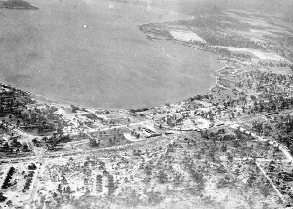
During periods of glacial retreat, when ocean levels were high, highland areas of central Florida became near-shore environments, including ocean dune systems and in some cases, isolated islands. The Lake Wales Ridge is an example of an ancient near-shore environment.

Since the last glacial retreat (and sea level high), Florida’s topography has been shaped primarily by rainfall and its interaction with underground rocks and sediments. Central Florida’s geology of unconsolidated sediments underlain by thin layers of clay and limestone has resulted in a concentration of sinkhole lakes. Limestone rocks dissolve away when exposed to acids. Rainfall is slightly acidic – due to a small concentration of carbonic acid from the dissolution of carbon dioxide from the atmosphere. Over thousands of years, preferential flow paths in the limestone rocks and the slightly acidic rainwater can result in large cavities in the rock. The clay layer over the cavity can mask it’s formation until the clay collapses in a catostrophic fashion. Crooked Lake was likely formed by multiple sinkhole collapses in close proximity over the last 5-10,000 years.


Modern History
Local Residents have Enjoyed, and impacted, Crooked Lake for over a Century
Crooked Lake is located within a closed basin. Except for very infrequent discharges south to Lake Clinch, surface water does not flow into our out of the Crooked Lake watershed. Therefore, the biggest influences on water levels and water quality are the activities within the watershed.
The earliest maps of Central Florida label present day Crooked Lake as Lake Okhakonkonhee. This is thought to be derived from the Creek Native American words Akhauke (mudhole) and Kunki (crooked) – a crooked lake with many mudholes. The first map with Crooked Lake, as it’s currently known, was published in 1888.
The eastern and northern shores of Crooked Lake are banked by steep rises in elevation, in some places more than 180 feet above the lake. The western and southern shores, however, are banked by lowlands that can be inundated when water levels rise. This led to several confrontations between groups of early settlers in the late 19th and early 20th centuries. Ranchers and farmers on the western and southern shores of Crooked Lake began digging ditches to drain the lowlands as early as the 1880s. This includes an outfall ditch that drains Crooked Lake south to Lake Clinch when water levels get high.
In 1922, property owners at the southern end of the lake widened and deepened the outfall ditch, which caused a precipitous drop in the lake level. A group of residents immediately obtained a court injunction to prevent the lowering of the lake. They also purchased land along the ditch and built an obstruction to stop the flow of water. Reportedly, the canal was cleared and obstructed multiple times over the first half of the 20th century.
In the middle of the 20th century, a permanent control structure was built in the ditch. The concrete weir was constructed with a top elevation of 120.0 feet NGVD 1929. Stop logs can be added to the weir to increase the elevation by approximately 2 feet. The control structure and most of the drainage ditch are located on private property. As such, the drainage ditch and control structure are not regularly maintained.
Following the hurricane season in late 2004, water levels in Crooked Lake rose substantially above the control weir elevation. This resulted in flooding of low-lying structures along the lake. Flow through the drainage ditch was slowed substantially due to vegetation growth and erosion in and around the ditch. Following complaints from local residents with low-lying properties, the Polk County Board of County Commissioners performed emergency maintenance on the ditch, clearing vegetation and restoring flow, which quickly brought lake levels down.
The following timeline highlight the major activities in the modern history of the Crooked Lake Watershed.
1856: Crooked Lake is first included on a map of central Florida as Lake Okhakonkonhee.

1881: Hamilton Disston signs a Contract with the Florida Inland Improvement Trust that allows him to drain submerged lands south of present-day Kissimmee and east of the Peace Creek. Crooked Lake is included in a map of the drainage area prepared by Disston’s company, the Atlantic and Gulf Coast Canal and Okeechobee Land Company, in their investment brochure from 1885. In an 1893 report to the Florida Legislature summarizing the drainage activities of the Disston Land Company, it was noted that “a canal was also constructed from Lochappopka Lake to Crooked Lake.” Lochappopka is the old name for Lake Clinch, as shown on an 1883 sectional map of Polk County.
1883: Crooked Lake is first included on a map of central Florida under its current name.

1886-1891: Stephen W. Carson moves his family from Fort Meade to a homestead on the east side of Lake Clinch (Quinn, 1990). Mr. Carson noted that crews working for the Disston Drainage project started work on the canal in April 1889. In his diaries, Mr. Carson notes that by September 1889, the canal was wide enough for a boat to travel through. However, by 1890, the canal did not appear to be making much impact on Crooked Lake levels, so the crews continued to dredge the canal. In December of 1890, Mr. Carson wrote to the Polk County News:
The Crooked Lake Drainage Company is nearing completion of their labors, and when planted in the ribbon cane or other varieties, the plantation will be one of the grandest in America. In rowing across the lake, I can thrust a pole in the mud eight feet deep. Mr. J.M. Kreamer, the superintendent of this grand enterprise can not receive too much praise. Besides his many business qualification, he is deservedly popular with all who have been so fortunate to make his acquaintance.
In May of 1891, the Florida Sugar and Rice Company was incorporated by Mr. Kreamer and planned to begin operations on Crooked Lake immediately. Mr. Kreamer was also superintendent of Hamilton Disston’s company, Atlantic and Gulf Coast Canal and Okeechobee Land Company, and was working on other sugar growing projects from St. Cloud to Lake Okeechobee. According to a history of Disston’s St. Cloud sugar plantation, his sugar company operations peaked around this time and started to decline. No record has been found to date of the Florida Sugar and Rice Company actually starting operations on Crooked Lake.
1901: Lindus Cody purchases a section of land near what is then known as Crooked Lake harbor. The area is now know as Cody Cove.

1912: H.E. Fairchild and I.A. Yarnell purchase several hundred acres in present-day Babson Park.

1912: Erle L. Wirt purchases a peninsula that juts into Crooked Lake, now known as Wirt’s point.
1912: The Atlantic Coast Line Railroad is constructed through present day Babson Park.
1915: Orren Ohlinger buys 60 acres between Wirt’s Point and Cody Cove.
1918: Scenic Highway is paved between Haines City and Frostproof.
1922: Property owners at the southern end of the lake widened and deepened the outfall ditch, which caused a precipitous drop in the lake level. A group of residents immediately obtained a court injunction to prevent the lowering of the lake. Source: Lake Wales Highlander, May 24, 1922.
1923: Renowned financier and statician Roger Babson purchases 440 acres on the north eastern shore of Crooked Lake.
1923: Local residents vote to change the name of the townsite from Crooked Lake to Babson Park, in recognition of Roger Babson’s investments in the area.

1923: The Crooked Lake Board of Trade submitted a request to the United States Geological Survey (USGS) to rename Crooked Lake to Lake Caloosa, which was accepted. The name change was immediately controversial with local reseidents. Multiple petitions were sent to the USGS to change the name back to Crooked Lake. Finally, in 1949, the USGS yielded to the local residents and changed the name on official maps back to Crooked Lake. Source: Quinn, 1990.

1923: Hillcrest Heights is incorporated on the land owned by H.E. Fairchild and I.A. Yarnell.

1949: Highway 27 is constructed through Polk County near the western shore of Crooked Lake.
1950s: Crooked Lake Park is constructed on the west side of Crooked Lake, including a series of dredged canals to provide lake access.
1968: Warner University founded on the west side of US 27, near Crooked Lake.
1987: Crooked Lake was designated as an Outstanding Florida Water by the Florida Legislature. Crooked Lake remains the only OFW in Polk County. According the Florida Department of Environmental Protection: An OFW is a water designated worthy of special protection because of its natural attributes. This special designation is applied to certain waters and is intended to protect existing good water quality.
1997: Polk County purchases Crooked Lake Prairie, a 525-acre property, for the purpose of protecting water, wildlife and wilderness resources.
2006: Bok Academy, a middle school run by the Lake Wales Charter Schools, founded on the west shore of Crooked Lake.
2008: Hillcrest Heights annexes Crooked Lake. Source: Lakeland Ledger, March 12, 2008.